 the ground-breaking tool for marketers: the ground-breaking tool for marketers:
Answers the need for proper and complete mapping of the more than 1300 urban and 180 rural Forward Sortation Areas (F.S.A.) in Canada.
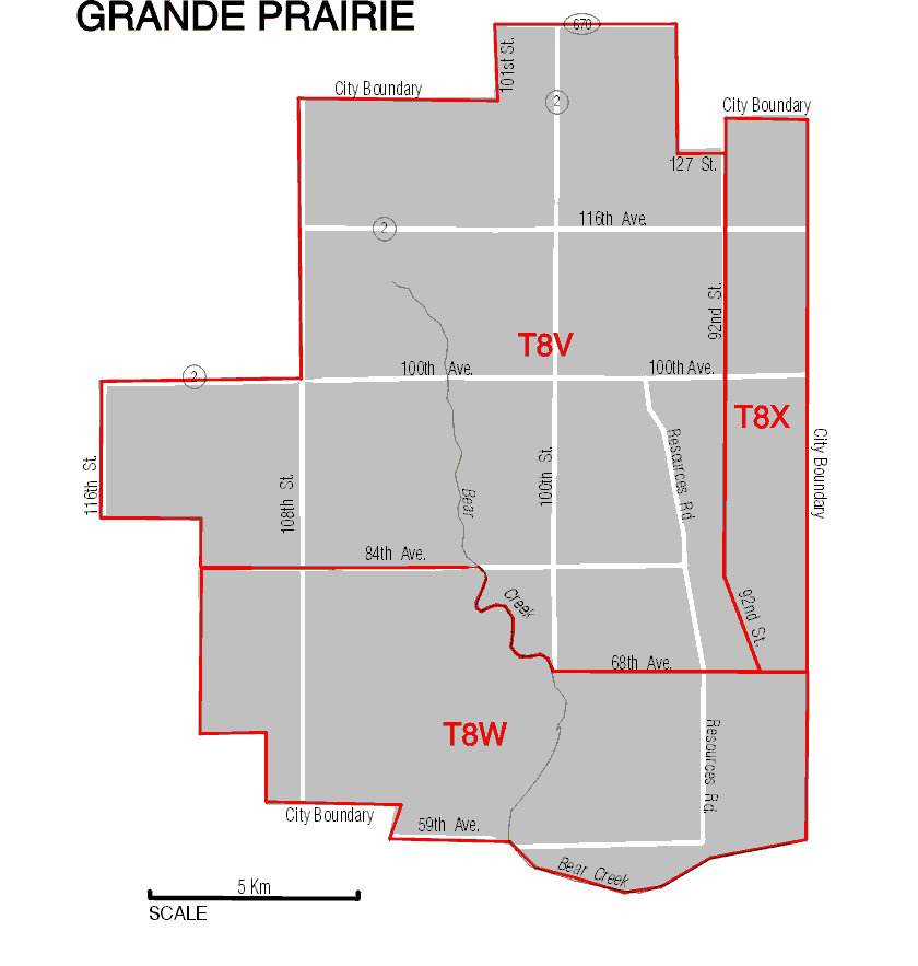
CITY MAP sample page
Rural AREA MAP sample page
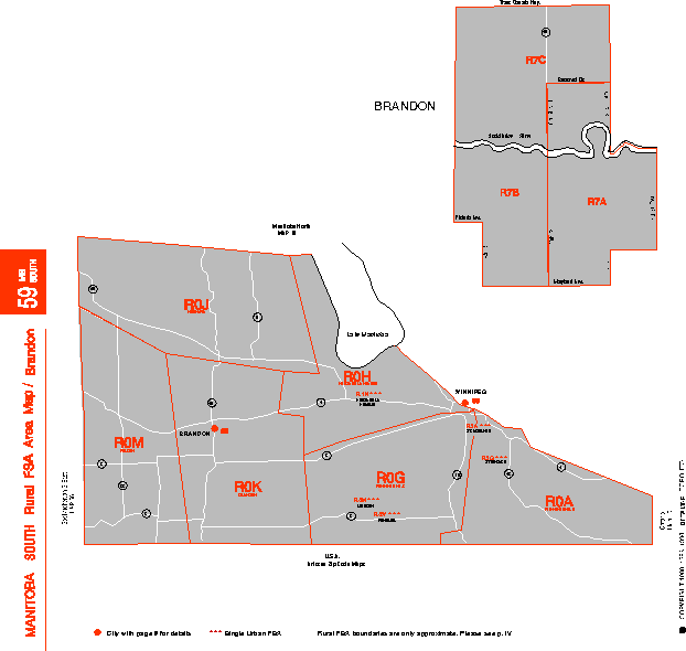
The new Atlas is in two colours, featuring 139 maps of cities and rural areas. It offers sufficient geographic reference (highways, streets, rivers etc.), as well as a comprehensive Index, referencing every locality with a post office in the country. This Seventh Edition brings you over 50 new and modified FSA boundaries, new Urban FSA Index by FSA and city name, numerous updates in the Rural Maps and Index, corrections of errors and omissions etc..
This publication answers the need for clearly defined boundaries, necessary for successful management. It will be appreciated by marketing and sales executives, service and distribution managers, direct mail companies, and any company, institution or government agency taking advantage of the established "ready-made" territory divisions of the Canadian Postal Coding System. Format: 11" x 11" . Easy to read print. 132 pages with six 11" x 17" foldouts.
Price: $145.00 ORDER THE ATLAS
Update Subscription (recommended), 4 semi-annual mailings of updated maps and indexes: $80
*The Atlas is also available in electronic form. For more details please call us.
To place your order by telephone please contact:
DATAMAP Electronic Mapping
HELPING MARKETERS SINCE 1976
56 Oakmeadow Blvd., Toronto, Ontario M1E 4G1
(416) 287-3240
e-mail: pblago@datamap.org
Last updated February 10, 2014
![]()